
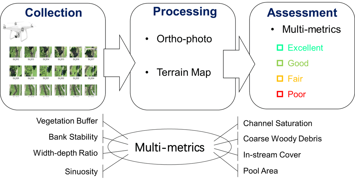
Develop a UAV-based toolkit to automate UAV flying, process UAV images, and classify the stream habitat health condition into excellent, good, fair, and poor categories.
Collaborate with Wisconsin DNR to use this toolkit for long-term monitoring of stream habitat health in Black Earth Creek, WI.
Code: Github Link
Publication: Environmental Monitoring and Assessment, 2025
Flash rip detection and characterization using refined cascade R-CNN
Shoreline change detection using a deep learning framework
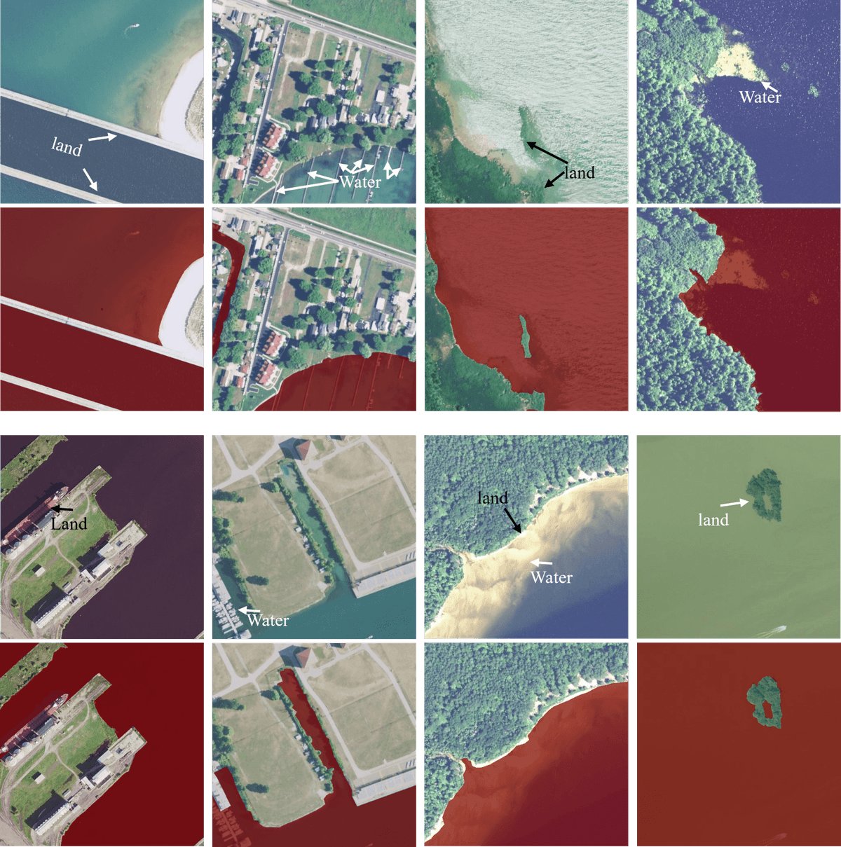
1. Coastal Aerial Imagery Dataset (CAID)
Developed a manually delineated dataset with more than 20,000 aerial images of size 500 times 500, with 1m or 0.6m resolution.
Raised water body area (WBA), shoreline length ratio (SLR), and mean water hue (MWH) to identify the representativeness of the dataset.
Provided benchmark performance for common image segmentation networks on shoreline segmentation tasks.
Raised mean shoreline covering ratio (mSRC) to target on shoreline segmentation evaluation.
Code: Github Link
Kaggle Competition: Kaggle Link
Dataset: Zenodo Link
Paper: IEEE Data Description, 2025

